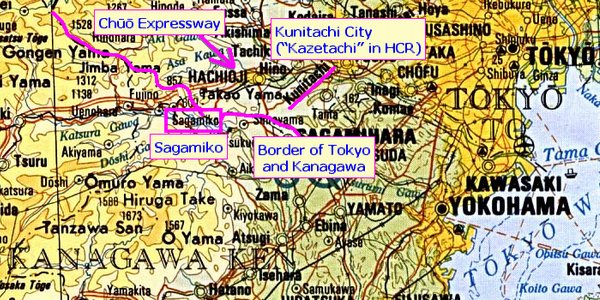
The map is from tokyo_topo_1977.jpg, Perry-Castañeda Library Map Collection.
See also Wikipedia::Chuo Expressway
(Pronunciation of “Chūō”... Chū is like t you as in don’t you and ō is like oh)
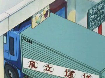 |
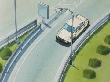
6:00 Entering the Chūō Expressway. This tollgate is probably the one at the Kunitachi-Fuchū Interchange (国立府中IC). Kazetachi (風立), where Hime-chan lives, is a fictional town based on Kunitachi (国立), a real city in the suburbs of Tokyo. |
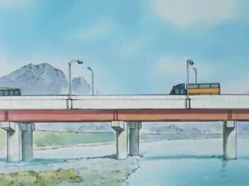 |
6:33 Driving west toward outside of Tokyo. This place is still in Tokyo. Probably the bridge over Tama River (Tama-gawa 多摩川). |
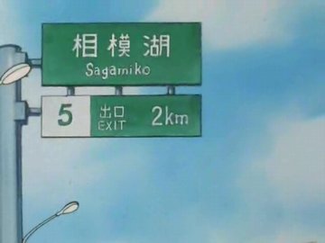 |
7:54 Now around Sagamiko (相模湖), a small town in the mountains by the border of Tokyo and Kanagawa. This place is already in Kanagawa. |
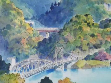 |
7:55 In Kanagawa, near Sagamiko. Lake Sagami is in the town of Sagamiko, and there are a lot of rivers and bridges around it. |
 |
8:00 Exiting from the Chūō Expressway. There are only two exits around this place; this must be either the Sagamiko Higashi Interchange (相模湖東IC) or the Sagamiko Interchange (相模湖IC). |
[ Hime-chan Index ]
")
821C DADD 2C25 C86C 1754 6412 DD33 0238 68B5 8C64]![]() Our website is Tor-friendly & JavaScript-free.
Our website is Tor-friendly & JavaScript-free.